


37 miles
~7,047 ft
on/off trail
permit required
Grizzly country
Introduction
It was September of 2020. Covid had just upended our lives. I was looking for an original exploration in the lower 48. While looking at satellite maps of the Yellowstone backcountry, I spotted an area with significant geothermal activity. The area is was named Hot Basin Group on most topographic maps and was located in a remote off-trail part of the North Eastern Yellowstone. Being a photographer, I looked online for photographs of the area and could not find any. I figured I ought to be the first one to head there and document it on the internet. I drew an on-trail / off-trail route that would take us through Specimen Ridge Trail and then off trail across the Yellowstone backcountry, east of the Grand Canyon of the Yellowstone. The last part of the adventure would have us join the falls of the Grand Canyon of the Yellowstone and exit there.
it was Summer 2020. Our Native Southern California was experiencing a 100F+ heatwave. We drove from LA to Yellowstone. We were greeted by a snowstorm and temperatures in the teens. What a blessing!
Directions
We drove to the trailhead of Specimen Ridge located on the northeast entrance road art GPS coordinate: 44.91692, -110.40003.
We secured wilderness permits ahead of our trips by reserving with the Yellowstone National Park backcountry office. The lady who booked our permit asked us whether we would be carrying firearms during our off trail traverse, to which we answered positively. She reminded us of the regulations in place. Be sure to get familiar with local regulations when travelling on public lands.
Bear deterrence
The Yellowstone backcountry is the home of the Grizzly Bear, the iconic American apex predator. Bushwhacking in this area require proper bear deterrence. Always carry a bear canister of a bear sack (usrsack) as well as bear spray or a firearm. Have your bear spray / firearms readily available on your belt / chest in the event of an attack and make sure to practice ahead of time. A bear spray buried in your backpack is not going to be of any use in the event of a surprise encounter.
Finally, your party should also have a plan of action in the event that something goes wrong. I usually instruct my partners to form a horizontal line to ensure no one is behind.
Day 1 - Specimen Ridge Trail
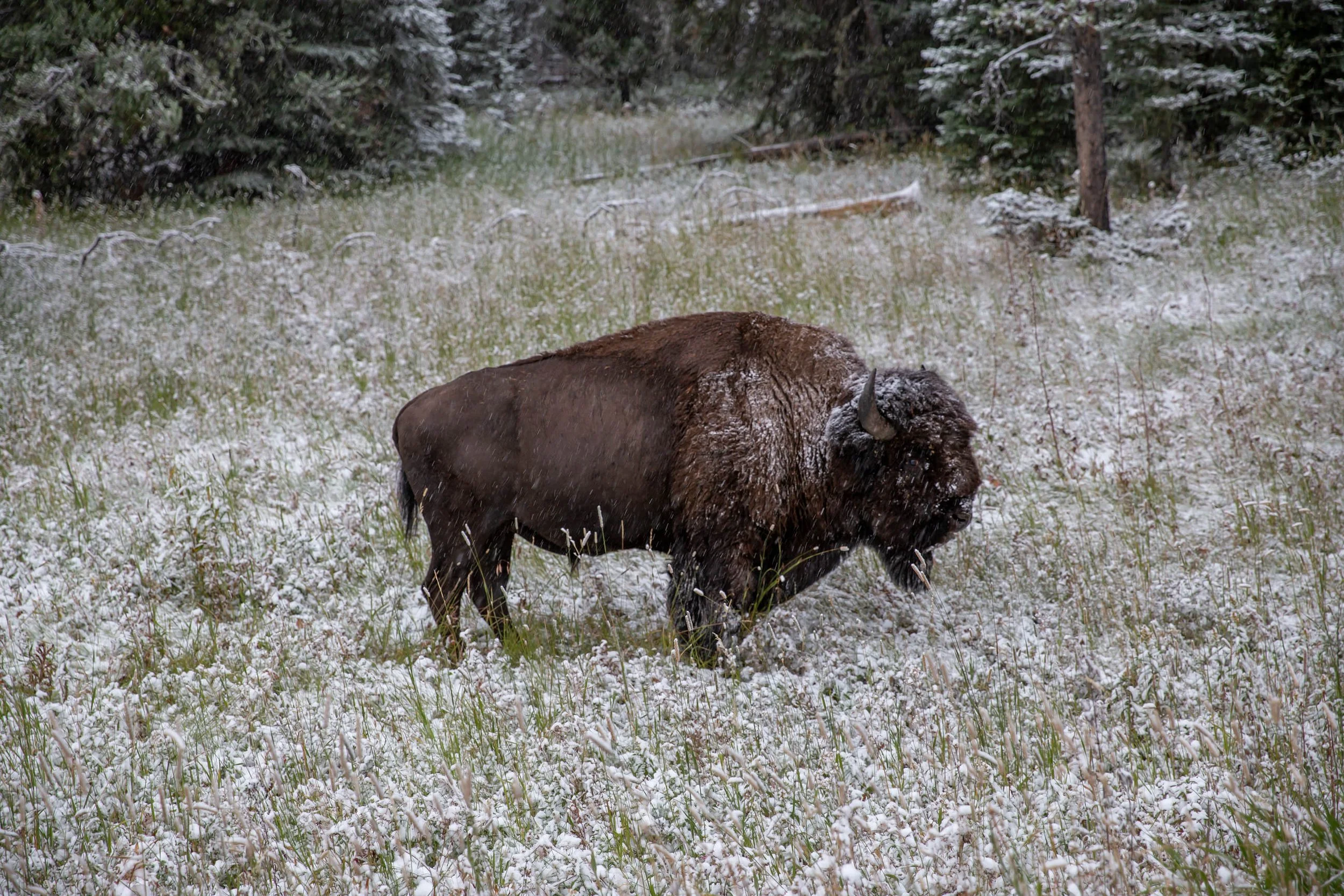
Our first day is strictly on-trail, however it has considerable elevation along with the fact that our pack are as heavy as they are going to be on that trip. We are at the beginning of September and the day is unusually colder. We were hit by a snowstorm the day’s prior and most of the trail is covered in snow. This is a stark reminded that winter conditions can hit anytime on the Yellowstone plateau. We follow a beautiful, mostly brushless open ridge called Specimen Ridge. It yields gorgeous views of the snowcapped mountains surrounding Yellowstone. We pass a multitude of dead Antler, a reminded that It is almost Fall, which is Elk’s season. Aiming to cover as much terrain as possible, we climb almost 3,000ft over 8.6 miles on that first day. Towards the end of the day, we run into a herd of wild buffalos on the narrow ridge. Seeing us approaching, the males form a barrier between us and their youth in an attempt to shelter them from what they see as potential danger. This is our first encounter with the ever abounding wildlife of Yellowstone. We decide to set up camp at this point. That night, the temperature gets down to 13F. I brave the cold to snap a few pictures of the Milky Way, effortlessly shining above our heads. Again, it is only early September, but Yellowstone, like a peacock is already showing its splendor.
Terrain profile for day 1


Day 2 - Amethyst Mountain to Off trail section
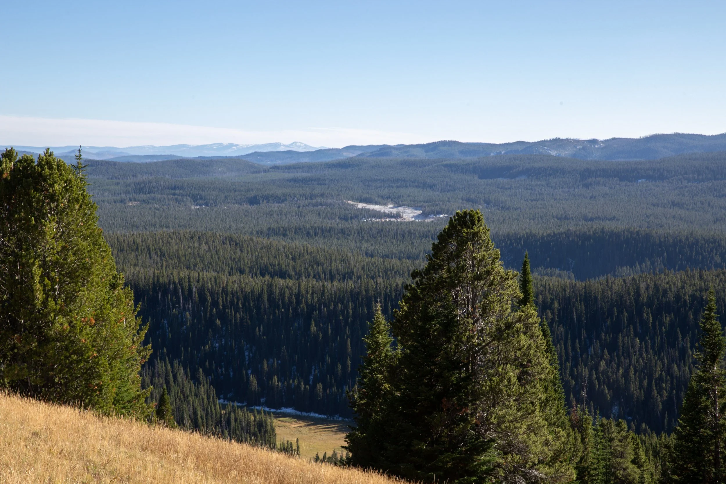
We wake up to a crisp morning. Today’s goal is to get onto the off-trail section of our journey and cover as much distance as possible. First, we have to climb Amethyst Mountain, Peaking at 9,600ft. Amethyst Mountain is one of the highest peak in the park .From the top, we glance at smoke in the distance, likely coming from the geothermal features we are aiming at. We follow the trail, making it to the summit before noon, at which point we start descending Southeast. The descent is sharp and takes us onto a wooded area. We suddenly shift from the brazen desert alpine to a lush forest which frankly smells like berries and roots. I tell my partners to watch out as we venture into the thick wood filled with wonderful forest scent. My instinct proves to be accurate as I suddenly glance at a full grown grizzly bear, busily foraging on a berry bush less than 40ft away from us. I spot the bear before he notices me and warns my partners. Eventually, the bear smells us and takes a peak at us. This is my first time making close eye contact with the predator. The first thing that strikes me is how smart this animal is. He carefully checks each and every one of us, individually. We stand right next to one another, silent, ready to face a potential charge. I am carrying a Marlin 45/70 guide gun, my friends are respectively caring bear spray as well as a 454 Casual Revolver. We’ve practiced using those weapons but would rather not have to resort to them. After carefully analyzing us, the grizzly makes the decision to charge the other way. Smart bear. I will never forget this encounter.
I get out of the wooded area onto an open plain, a far safer area as far as bear encounters go. We take a rest. I pride myself on spotting the grizzly before it even noticed me, which tells me it was definitely a male grizzly :). Female tend to be much more alert, especially when accompanied with cubs.
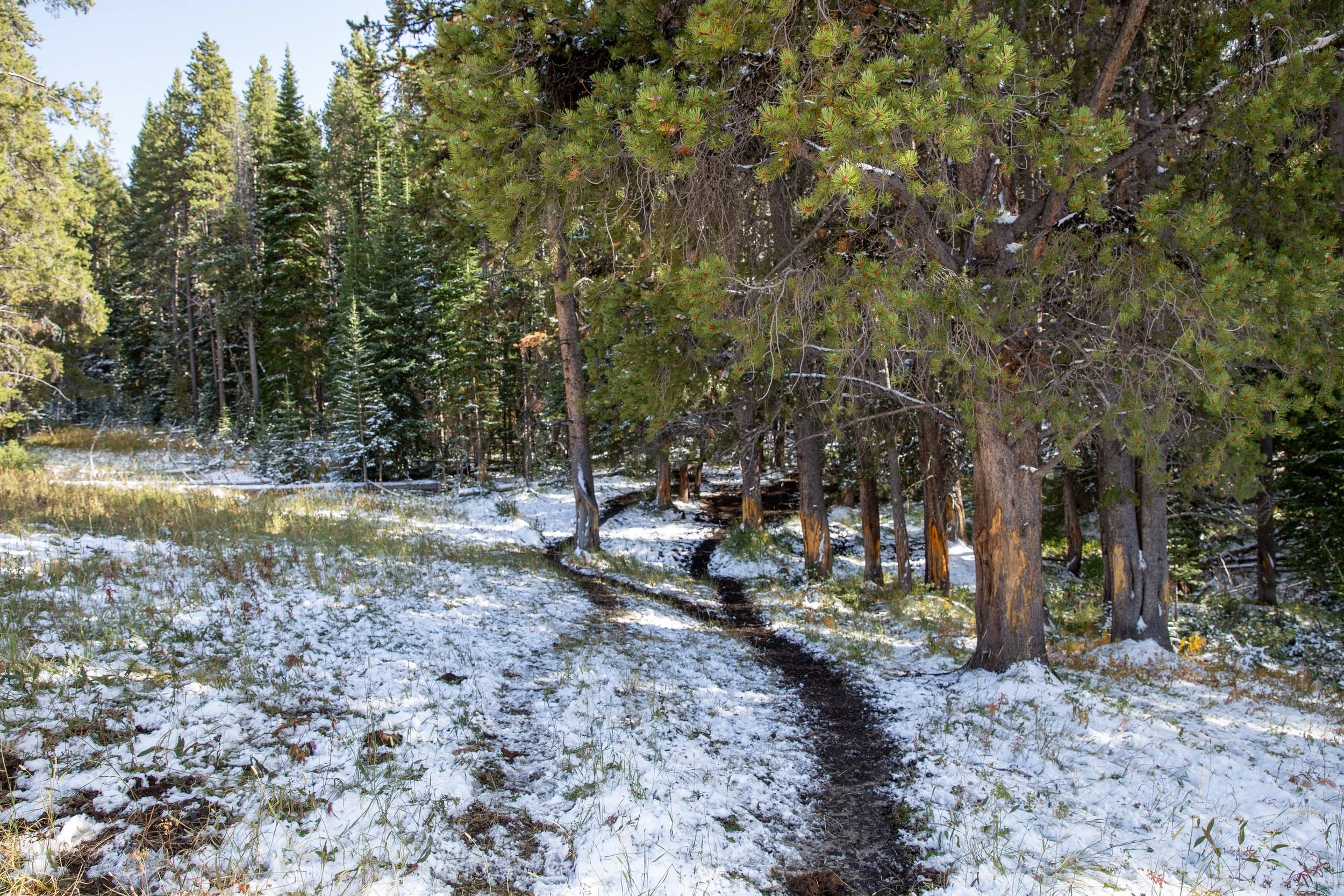
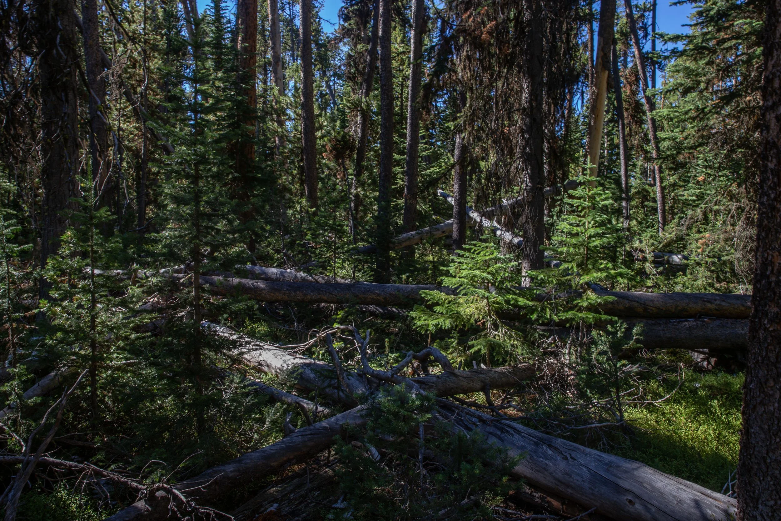
At this point, we leave the trail to go off trail. Travelling off trail is always tricky and requires good preparation, mapping and navigation skills. We cross a network of open valleys and thick Forrests over rolling hills. The forrest sometimes has heavy amount of fallen trees, making our passage sometimes difficult.
We eventually spot a game trail which we follow. Bear scat is ever present along the trail. Finally, we make it to Deep Creek, a year-round following creek bordering a wide open valley with soft grass. We decide to call this valley our home for the night.
We only travelled 6.86 miles for the day, however off-trail travel is a lot more cumbersome, time and energy consuming than regular on-trail travel.
Terrain profile for day 2


Day 3 - Hot Basin Group - Off trail day
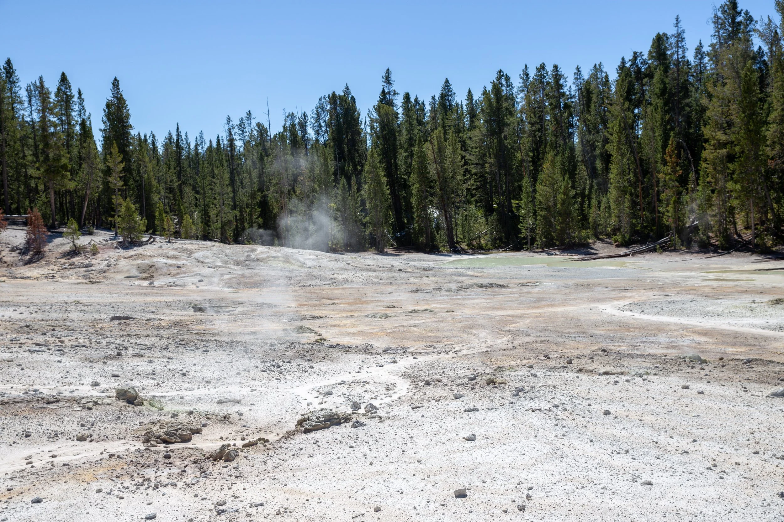
Today is another day spent off trail. The first half of the day was spemt crossing steep rolling hills with extremely thick wood and brush. Sometimes we’d catch a game trail which would ease our travel but for the most part, this is a tough challenging day. Around mid-day, we encounter our first geothermal feature, a massive pit with boiling water (and perhaps acidic) with a massive column of smoke rising from what seems to be the center of the earth.
When faced with such terriyifing beauty from nature, I understand why for so many decades, the Yellowstone plateau was called “Colter’s hell”. John Colter, a former member of the Jewish & Clark Expedition was the first white man to discover the plateau. To this day, his story is still hard to believe. He was captured by a local native tribe. During his captivity, he managed to escape. Running away from the Indians, virtually naked and barefoot during the Yellowstone winter, he discovered the geothermal features and geysers of the park, providing relief from the cold but also inspiring the ire of his fellowmen back east who when they heard the story thought he had gone mad. He was only credited for his discovery after his death when an official party confirmed his tale. A monument dedicated to his life now stands at the Jackson Hole town square.
Yet, we take caution when approaching the geothermal feature. A few days ago, a tourist fell in a pool around Mammoth Springs. The next day, the rangers could only locate his wallet and boots. His entire body had dissolved overnight in the acidic waters.
We make our way towards the main topographic element of the Hot Basin Group. Suddenly, the scenery radically changes. We go from lush green forest to a barren sulfuric valley, surrounded with geysers and acidic pools. The smell of sulfure is now ever present in the air. The temperature is much higher. The life that was once so abundant is now a mere souvenir. We cross this valley of death cautiously. The ground is sandy and sometimes gives under our weight. I snap as many shots as I can before heading further south onto more rolling hills.
We spend the rest of the day negotiating thick brush. Our pace is sometimes satisfying, sometimes deceiving, depending on the nature of the terrain we encounter.
We eventually make it to Shallow Creek and onto the Wapiti Lake Trail, marking the end of our nearly two-day off trail crossing. We stop at the Lake for a well deserved dump! It’s always a treat to rinse ourselves when in the backcountry. We cover a few more miles during the day before stopping for the night. Today was one of the hardest day physically, but also one of the most rewarding. We get a well deserved sip of whiskey before heading to bed.
Terrain profile for day 3


Day 4 - Grand Canyon of the Yellowstone
Today is our last day and consists mostly of covering the remainder of the trail back to the Grand Canyon of the Yellowstone. We walk a hefty pace and for the very first time since the beginning of our trip start running into souls, always a strange sight when you are secluded in the backcountry for so long.
We walk through high valleys and Forests for a total of 14.21miles, up 787ft and down almost 2,000ft. We eventually make it to the rim of the Grand Canyon. We stop at one of the popular view points. We can help but feel at odds with the crowd. Toursists are well dressed and groomed. We are dusty, smelly and our clothes damaged by the thick brush. People seem sometimes more interested in us than the landscape they drove so long to see. Yet, we feel the exuberant feeling from the adventure we’ve just experienced. We’ve covered a total of 40 miles over 7,000 ft of gain, including a considerable amount of off-trail traveling. Yellowstone is often viewed from the side of the road, however for those who dare, its backcountry reveals some of the most beautiful secret of the American West.
Terrain profile for day 4


